
San José del Guaviare topographic map
Interactive map
Click on the map to display elevation.
About this map
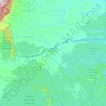
Name: San José del Guaviare topographic map, elevation, terrain.
Location: San José del Guaviare, Guaviare, Colombia (2.01187 -73.65709 2.92484 -70.50676)
Average elevation: 284 m
Minimum elevation: 134 m
Maximum elevation: 4,144 m
Other topographic maps
Click on a map to view its topography, its elevation and its terrain.
Corocoro
Colombia > Guaviare > San José del Guaviare
Corocoro, San José del Guaviare, Guaviare, RAP Amazonía, Colombia
Average elevation: 214 m