
Nariño topographic map
Interactive map
Click on the map to display elevation.
About this map
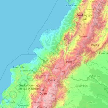
Name: Nariño topographic map, elevation, terrain.
Location: Nariño, Colombia (-1.06000 -80.56001 4.06000 -75.44001)
Average elevation: 797 m
Minimum elevation: -3 m
Maximum elevation: 5,469 m
Other topographic maps
Click on a map to view its topography, its elevation and its terrain.