
Coney Island topographic map
Interactive map
Click on the map to display elevation.
About this map
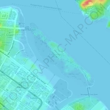
Name: Coney Island topographic map, elevation, terrain.
Location: Coney Island, Punggol, Northeast, Singapore (1.40155 103.91503 1.41742 103.93121)
Average elevation: 5 m
Minimum elevation: -4 m
Maximum elevation: 59 m
Other topographic maps
Click on a map to view its topography, its elevation and its terrain.
Lorong Halus
Lorong Halus, Pasir Ris, Northeast, Singapore
Average elevation: 6 m