
Thank you for supporting this site ❤️
Make a donation
Make a donation
Våler topographic map
Click on the map to display elevation.
Thank you for supporting this site ❤️
Make a donation
Make a donation
About this map
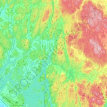
Name: Våler topographic map, elevation, terrain.
Location: Våler, Viken, Norway (59.38699 10.76577 59.54197 11.13792)
Average elevation: 88 m
Minimum elevation: 12 m
Maximum elevation: 225 m
Thank you for supporting this site ❤️
Make a donation
Make a donation
Other topographic maps
Click on a map to view its topography, its elevation and its terrain.