
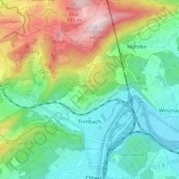
Trimbach topographic map
Interactive map
Click on the map to display elevation.
About this map
Name: Trimbach topographic map, elevation, terrain.
Average elevation: 557 m
Minimum elevation: 381 m
Maximum elevation: 917 m
Other topographic maps
Click on a map to view its topography, its elevation and its terrain.
Olten
Suisse > Soleure > Amtei Olten-Gösgen
Olten, Bezirk Olten, Amtei Olten-Gösgen, Soleure, Suisse
Average elevation: 475 m
Gunzgen
Suisse > Soleure > Amtei Olten-Gösgen > Gunzgen
Gunzgen, Bezirk Olten, Amtei Olten-Gösgen, Soleure, 4617, Suisse
Average elevation: 434 m