
Thank you for supporting this site ❤️
Make a donation
Make a donation
Sudong-ri topographic map
Click on the map to display elevation.
Thank you for supporting this site ❤️
Make a donation
Make a donation
About this map
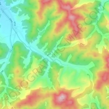
Name: Sudong-ri topographic map, elevation, terrain.
Location: Sudong-ri, Chuncheon-si, Gangwon State, 24411, South Korea (37.75807 127.64545 37.79807 127.68545)
Average elevation: 213 m
Minimum elevation: 76 m
Maximum elevation: 395 m
Thank you for supporting this site ❤️
Make a donation
Make a donation
Other topographic maps
Click on a map to view its topography, its elevation and its terrain.
Thank you for supporting this site ❤️
Make a donation
Make a donation
Thank you for supporting this site ❤️
Make a donation
Make a donation