
Thank you for supporting this site ❤️
Make a donation
Make a donation
Mount Pisa topographic map
Click on the map to display elevation.
Thank you for supporting this site ❤️
Make a donation
Make a donation
About this map
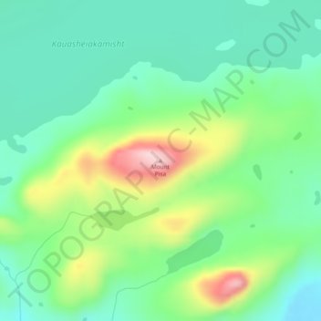
Name: Mount Pisa topographic map, elevation, terrain.
Location: Mount Pisa, Labrador, Newfoundland and Labrador, Canada (54.26114 -61.55386 54.26124 -61.55376)
Average elevation: 296 m
Minimum elevation: 221 m
Maximum elevation: 461 m
Thank you for supporting this site ❤️
Make a donation
Make a donation
Other topographic maps
Click on a map to view its topography, its elevation and its terrain.