
Jale topographic map
Interactive map
Click on the map to display elevation.
About this map
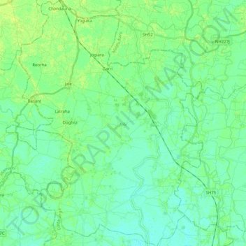
Name: Jale topographic map, elevation, terrain.
Location: Jale, Darbhanga, Bihar, Índia (26.26636 85.67585 26.44693 85.83896)
Average elevation: 53 m
Minimum elevation: 48 m
Maximum elevation: 60 m
Other topographic maps
Click on a map to view its topography, its elevation and its terrain.
Patná
Índia > Bihar > Patna Rural
Patná, Patna Rural, Patna District, Bihar, 800001, Índia
Average elevation: 51 m