
Nawada topographic map
Interactive map
Click on the map to display elevation.
About this map
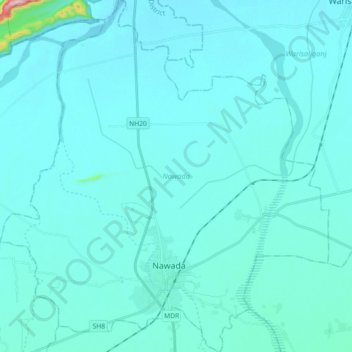
Name: Nawada topographic map, elevation, terrain.
Location: Nawada, Nawada District, Bihar, Índia (24.85278 85.45838 25.01634 85.62736)
Average elevation: 83 m
Minimum elevation: 64 m
Maximum elevation: 371 m
Other topographic maps
Click on a map to view its topography, its elevation and its terrain.
Patná
Índia > Bihar > Patna Rural
Patná, Patna Rural, Patna District, Bihar, 800001, Índia
Average elevation: 51 m