
मुस्ताङ topographic map
Interactive map
Click on the map to display elevation.
About this map
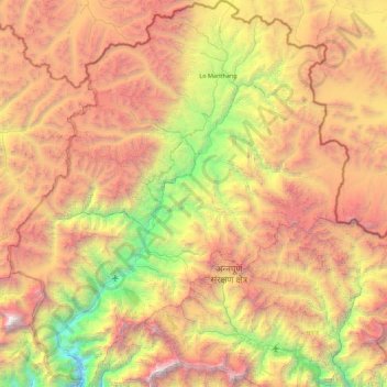
Name: मुस्ताङ topographic map, elevation, terrain.
Location: मुस्ताङ, Gandaki Pradesh, 33100, Nepal (28.56450 83.47900 29.33125 84.25171)
Average elevation: 4,938 m
Minimum elevation: 2,335 m
Maximum elevation: 8,142 m
Other topographic maps
Click on a map to view its topography, its elevation and its terrain.
Annapurna
Nepal > Gandaki Pradesh > म्याग्दी
Annapurna, म्याग्दी, Gandaki Pradesh, Nepal
Average elevation: 3,389 m
Jomsom
Nepal > Gandaki Pradesh > मुस्ताङ
Jomsom, Gharapjhong, मुस्ताङ, Gandaki Pradesh, Nepal
Average elevation: 3,061 m
Dhaulagiri
Nepal > Gandaki Pradesh > म्याग्दी
Dhaulagiri, Dhaulagiri-04, Dhaulagiri, म्याग्दी, Gandaki Pradesh, Nepal
Average elevation: 7,321 m