
Al Wusta Governorate topographic map
Interactive map
Click on the map to display elevation.
About this map
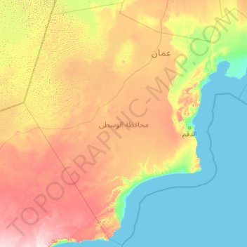
Name: Al Wusta Governorate topographic map, elevation, terrain.
Location: Al Wusta Governorate, Oman (17.85898 55.00000 21.48764 58.92014)
Average elevation: 104 m
Minimum elevation: -2 m
Maximum elevation: 459 m
Other topographic maps
Click on a map to view its topography, its elevation and its terrain.
Sohar
Oman > Al Batinah North Governorate
Sohar, Al Batinah North Governorate, 311, Oman
Average elevation: 27 m
Nizwa
Oman > Ad Dakhiliyah Governorate
Nizwa, Ad Dakhiliyah Governorate, 611, Oman
Average elevation: 774 m
Jabal Akhdar
Oman > Al Batinah South Governorate
Jabal Akhdar, Al Batinah South Governorate, Oman
Average elevation: 1,521 m
Sint
Oman > Ad Dhahirah Governorate > Sint
Sint, Ad Dhahirah Governorate, Oman
Average elevation: 981 m