
Río Guaviare topographic map
Interactive map
Click on the map to display elevation.
About this map
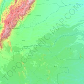
Name: Río Guaviare topographic map, elevation, terrain.
Location: Río Guaviare, Guaviare, 95001, Colombia (2.18603 -74.58389 4.08079 -67.70958)
Average elevation: 402 m
Minimum elevation: 50 m
Maximum elevation: 5,190 m
Other topographic maps
Click on a map to view its topography, its elevation and its terrain.
Corocoro
Colombia > Guaviare > San José del Guaviare
Corocoro, San José del Guaviare, Guaviare, RAP Amazonía, Colombia
Average elevation: 214 m
San José del Guaviare
Colombia > Guaviare > San José del Guaviare
San José del Guaviare, Guaviare, Colombia
Average elevation: 284 m