
Rietvlei Wetland Reserve topographic map
Interactive map
Click on the map to display elevation.
About this map
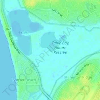
Name: Rietvlei Wetland Reserve topographic map, elevation, terrain.
Average elevation: 5 m
Minimum elevation: -1 m
Maximum elevation: 16 m
Other topographic maps
Click on a map to view its topography, its elevation and its terrain.
Table Mountain
South Africa > Western Cape > City of Cape Town > Cape Town
Table Mountain, Cape Town Ward 54, Cape Town, City of Cape Town, Western Cape, 8040, South Africa
Average elevation: 583 m
Llandudno Beach
South Africa > Western Cape > City of Cape Town > Cape Town > Llandudno
Llandudno Beach, Llandudno, Cape Town Ward 74, Cape Town, City of Cape Town, Western Cape, South Africa
Average elevation: 108 m
Trafalgar Park
South Africa > Western Cape > City of Cape Town > Cape Town
Trafalgar Park, Cape Town Ward 115, Cape Town, City of Cape Town, Western Cape, 7925, South Africa
Average elevation: 50 m
Green Point Park
South Africa > Western Cape > City of Cape Town > Cape Town
Green Point Park, Green Point, Cape Town, City of Cape Town, Western Cape, 8005, South Africa
Average elevation: 30 m
Table Mountain (Maclear's beacon)
South Africa > Western Cape > City of Cape Town > Cape Town
Table Mountain (Maclear's beacon), Cape Town, City of Cape Town, Western Cape, 7735, South Africa
Average elevation: 675 m
Nantes
South Africa > Western Cape > City of Cape Town > Cape Town
Nantes, Silvertown, Cape Town, City of Cape Town, Western Cape, South Africa
Average elevation: 14 m
Silvermist Estate
South Africa > Western Cape > City of Cape Town > Cape Town
Silvermist Estate, Cape Town Ward 74, Cape Town, City of Cape Town, Western Cape, 7848, South Africa
Average elevation: 272 m
Blinkwater
South Africa > Western Cape > City of Cape Town > Cape Town
Blinkwater, Bakoven, Cape Town Ward 54, Cape Town, City of Cape Town, Western Cape, 8005, South Africa
Average elevation: 293 m
Elsieskraal River
South Africa > Western Cape > City of Cape Town > Cape Town
Elsieskraal River, Pinelands, Cape Town Ward 53, Cape Town, City of Cape Town, Western Cape, 7450, South Africa
Average elevation: 11 m
Newlands Forest
South Africa > Western Cape > City of Cape Town > Cape Town
Newlands Forest, Cape Town, City of Cape Town, Western Cape, South Africa
Average elevation: 331 m
Castle of Good Hope
South Africa > Western Cape > City of Cape Town > Cape Town
Castle of Good Hope, Oranje Bastion, Foreshore, Cape Town Ward 115, Cape Town, City of Cape Town, Western Cape, 8001, South Africa
Average elevation: 38 m