
Thank you for supporting this site ❤️
Make a donation
Make a donation
Lyantonde topographic map
Click on the map to display elevation.
Thank you for supporting this site ❤️
Make a donation
Make a donation
About this map
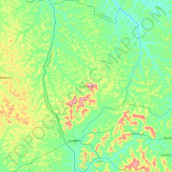
Name: Lyantonde topographic map, elevation, terrain.
Location: Lyantonde, Central Region, Uganda (-0.49095 31.06770 -0.02772 31.33211)
Average elevation: 1,295 m
Minimum elevation: 1,208 m
Maximum elevation: 1,537 m
Thank you for supporting this site ❤️
Make a donation
Make a donation
Other topographic maps
Click on a map to view its topography, its elevation and its terrain.
Thank you for supporting this site ❤️
Make a donation
Make a donation
Thank you for supporting this site ❤️
Make a donation
Make a donation