
Beckham County topographic map
Interactive map
Click on the map to display elevation.
About this map
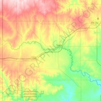
Name: Beckham County topographic map, elevation, terrain.
Location: Beckham County, Oklahoma, USA (35.02977 -100.00042 35.50876 -99.35880)
Average elevation: 602 m
Minimum elevation: 490 m
Maximum elevation: 776 m
Other topographic maps
Click on a map to view its topography, its elevation and its terrain.
Razorback Mountain
Razorback Mountain, Pushmataha County, Oklahoma, 74557, USA
Average elevation: 231 m