
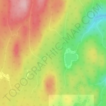
Sandrift Creek topographic map
Interactive map
Click on the map to display elevation.
About this map
Name: Sandrift Creek topographic map, elevation, terrain.
Average elevation: 1,276 m
Minimum elevation: 1,182 m
Maximum elevation: 1,354 m
Other topographic maps
Click on a map to view its topography, its elevation and its terrain.
Area D (Kiskatinaw Valley)
Canada > British Columbia > Peace River Regional District
Average elevation: 1,024 m
Area A (Kyuquot/Nootka/Sayward)
Canada > British Columbia > Strathcona Regional District
Average elevation: 390 m
Anahim Lake
Canada > British Columbia > Cariboo Regional District > Area J (West Chilcotin)
Average elevation: 1,101 m
Bella Coola
Canada > British Columbia > Central Coast Regional District > Area E (West Bella Coola/Clayton Falls/Tallheo)
There is a 454 km mostly paved road connection by Highway 20 to Williams Lake. The 137 kilometre section from Bella Coola to Anahim Lake was built in 1953 by local residents, and features a 15 km ascent from the Valley floor to the Chilcotin plateau, gaining 1600 metres in elevation to the summit at Heckman…
Average elevation: 437 m
Nimpo Lake
Canada > British Columbia > Cariboo Regional District > Area J (West Chilcotin)
Nimpo Lake is the jumping off point to the wilderness, much of it inaccessible to people except by floatplane or on foot. You can go flightseeing over Hunlen Falls, the third longest freefalling waterfall in Canada, or fly over the multicolored Rainbow Mountains or Monarch Mountain and see the pristine…
Average elevation: 1,150 m
Area G (Forster Creek/Mount Assiniboine)
Canada > British Columbia > Regional District of East Kootenay
Average elevation: 1,808 m
Interior Plateau
Canada > British Columbia > Regional District of Bulkley-Nechako > Area E (Ootsa Lake/François Lake)
Average elevation: 896 m
Kelowna
Canada > British Columbia > Regional District of Central Okanagan
Kelowna is classified as a humid continental climate or an inland oceanic climate per the Köppen climate classification system due to its coldest month having an average temperature slightly above −3.0 °C (26.6 °F) and below 0 °C (32 °F), with dry, hot, sunny summers and cool, cloudy winters, and four…
Average elevation: 704 m
West Kelowna
Canada > British Columbia > Regional District of Central Okanagan
Average elevation: 649 m
Area F (Willow River/Upper Fraser)
Canada > British Columbia > Regional District of Fraser-Fort George
Average elevation: 1,179 m
Queen Charlotte
Canada > British Columbia > Queen Charlotte (Village) > Queen Charlotte
Average elevation: 113 m
Enderby
Canada > British Columbia > Regional District of North Okanagan > Enderby > Enderby
Latitude-Longitude: 50°33′03.0″N 119°08′22.7″W / 50.550833°N 119.139639°W / 50.550833; -119.139639 elevation: 360 metres
Average elevation: 511 m
Grindrod
Canada > British Columbia > Regional District of North Okanagan > Area F (Grindrod/Ashton Creek/Mabel Lake) > Grindrod
Average elevation: 406 m