
Craig County topographic map
Click on the map to display elevation.
About this map
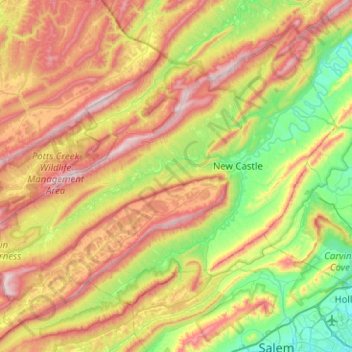
Name: Craig County topographic map, elevation, terrain.
Location: Craig County, Virginia, United States (37.31638 -80.47278 37.66029 -79.96906)
Average elevation: 656 m
Minimum elevation: 300 m
Maximum elevation: 1,170 m
Other topographic maps
Click on a map to view its topography, its elevation and its terrain.
Middleburg
United States > Virginia > Loudoun County
According to the United States Census Bureau, the town has a total area of 0.6 square mile (1.5 km2), all land. The elevation is 486 feet.
Average elevation: 144 m