
Amherst County topographic map
Click on the map to display elevation.
About this map
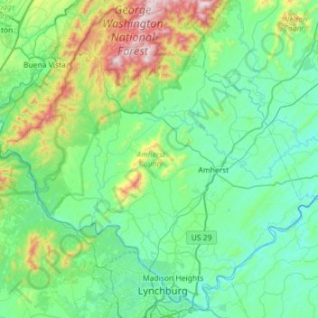
Name: Amherst County topographic map, elevation, terrain.
Location: Amherst County, Virginia, United States (37.38581 -79.43694 37.81416 -78.86794)
Average elevation: 329 m
Minimum elevation: 123 m
Maximum elevation: 1,225 m
Other topographic maps
Click on a map to view its topography, its elevation and its terrain.
Middleburg
United States > Virginia > Loudoun County
According to the United States Census Bureau, the town has a total area of 0.6 square mile (1.5 km2), all land. The elevation is 486 feet.
Average elevation: 144 m