
Bouvet Island topographic map
Interactive map
Click on the map to display elevation.
About this map
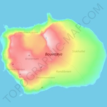
Name: Bouvet Island topographic map, elevation, terrain.
Location: Bouvet Island, Norway (-54.45288 3.28576 -54.38692 3.43338)
Average elevation: 189 m
Minimum elevation: -2 m
Maximum elevation: 749 m
Other topographic maps
Click on a map to view its topography, its elevation and its terrain.