
Lunner topographic map
Interactive map
Click on the map to display elevation.
About this map
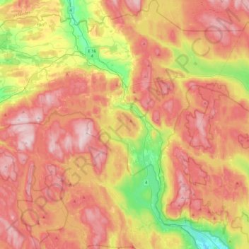
Name: Lunner topographic map, elevation, terrain.
Location: Lunner, Viken, Norway (60.13161 10.45635 60.33912 10.86474)
Average elevation: 457 m
Minimum elevation: 165 m
Maximum elevation: 702 m
Other topographic maps
Click on a map to view its topography, its elevation and its terrain.