
North East Land topographic map
Interactive map
Click on the map to display elevation.
About this map
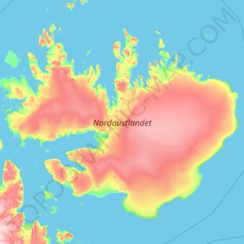
Name: North East Land topographic map, elevation, terrain.
Location: North East Land, Svalbard, Norway (79.20989 17.71146 80.50793 27.23729)
Average elevation: 156 m
Minimum elevation: -3 m
Maximum elevation: 1,172 m
Other topographic maps
Click on a map to view its topography, its elevation and its terrain.