
San Marcos topographic map
Interactive map
Click on the map to display elevation.
About this map
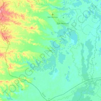
Name: San Marcos topographic map, elevation, terrain.
Location: San Marcos, San Jorge, Sucre, Colombia (8.39784 -75.34725 8.74066 -75.01328)
Average elevation: 30 m
Minimum elevation: 11 m
Maximum elevation: 105 m
Other topographic maps
Click on a map to view its topography, its elevation and its terrain.
La Soledad
Colombia > Sucre > Los Palmitos
La Soledad, Los Palmitos, Sabanas, Sucre, RAP Caribe, Colombia
Average elevation: 195 m
Pajonal
Colombia > Sucre > San Onofre > Pajonal
Pajonal, San Onofre, Morrosquillo, Sucre, Colombia
Average elevation: 76 m