
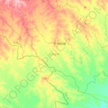
El Roble topographic map
Interactive map
Click on the map to display elevation.
About this map
Name: El Roble topographic map, elevation, terrain.
Location: El Roble, Sabanas, Sucre, Colombia (8.98885 -75.27352 9.16925 -75.02061)
Average elevation: 78 m
Minimum elevation: 18 m
Maximum elevation: 159 m
Other topographic maps
Click on a map to view its topography, its elevation and its terrain.
La Soledad
Colombia > Sucre > Los Palmitos
La Soledad, Los Palmitos, Sabanas, Sucre, RAP Caribe, Colombia
Average elevation: 195 m
Pajonal
Colombia > Sucre > San Onofre > Pajonal
Pajonal, San Onofre, Morrosquillo, Sucre, Colombia
Average elevation: 76 m