
Make a donation
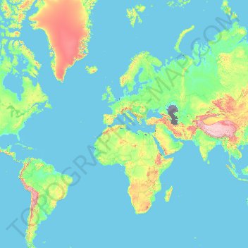
Norway topographic map
Click on the map to display elevation.
Make a donation
Norway
Little has been found dating from the early Iron Age (the last 500 years BC). The dead were cremated, and their graves contain few burial goods. During the first four centuries AD, the people of Norway were in contact with Roman-occupied Gaul. About 70 Roman bronze cauldrons, often used as burial urns, have been found. Contact with the civilised countries farther south brought a knowledge of runes; the oldest known Norwegian runic inscription dates from the third century. At this time, the amount of settled area in the country increased, a development that can be traced by coordinated studies of topography, archaeology, and place-names. The oldest root names, such as nes, vik, and bø ("cape," "bay," and "farm"), are of great antiquity, dating perhaps from the Bronze Age, whereas the earliest of the groups of compound names with the suffixes vin ("meadow") or heim ("settlement"), as in Bjǫrgvin (Bergen) or Sǿheim (Seim), usually date from the first century AD.
Make a donation
About this map
Name: Norway topographic map, elevation, terrain.
Location: Norway (-54.65400 -9.68463 81.02802 34.68891)
Average elevation: 294 m
Minimum elevation: -30 m
Maximum elevation: 7,179 m
Make a donation
Other topographic maps
Click on a map to view its topography, its elevation and its terrain.
Pretoria
South Africa > Gauteng > City of Tshwane Metropolitan Municipality
Pretoria is situated approximately 55 km (34 mi) north-northeast of Johannesburg in the northeast of South Africa, in a transitional belt between the plateau of the Highveld to the south and the lower-lying Bushveld to the north. It lies at an altitude of about 1,339 m (4,393 ft) above sea level, in a warm,…
Average elevation: 1,363 m
Mamelodi
South Africa > Gauteng > City of Tshwane Metropolitan Municipality
Average elevation: 1,319 m
Make a donation
Cape Town
South Africa > Western Cape > City of Cape Town
The Cape Peninsula is 52 km long from Mouille Point in the north to Cape Point in the south, with an area of about 470 km2, and it displays more topographical variety than other similar sized areas in southern Africa, and consequently spectacular scenery. There are diverse low-nutrient soils, large rocky…
Average elevation: 53 m
Umlazi
South Africa > KwaZulu-Natal > eThekwini Metropolitan Municipality
Umlazi is situated on a series of undulating hills at an average elevation of 101 metres above sea level between the uMlaza River to the north and the uMbokodweni River to the south. Another river running through Umlazi is the Siphingo River which also runs towards the south of the township.
Average elevation: 100 m
Thohoyandou
South Africa > Limpopo > Vhembe District Municipality > Thulamela Local Municipality
Average elevation: 632 m
Make a donation
Pietermaritzburg
South Africa > KwaZulu-Natal > uMgungundlovu District Municipality
Average elevation: 853 m
Sebokeng
South Africa > Gauteng > Sedibeng District Municipality > Emfuleni Local Municipality
Average elevation: 1,523 m
Middelburg
South Africa > Mpumalanga > Nkangala > Steve Tshwete Local Municipality
Average elevation: 1,493 m
Make a donation
Giyani
South Africa > Limpopo > Mopani District Municipality > Greater Giyani Local Municipality
Average elevation: 481 m
Hazyview
South Africa > Mpumalanga > Ehlanzeni District Municipality > Mbombela
Average elevation: 554 m
Groblersdal
South Africa > Limpopo > Sekhukhune District Municipality > Elias Motsoaledi Local Municipality
Average elevation: 939 m
Vaal Dam
South Africa > Free State > Fezile Dabi District Municipality > Metsimaholo Local Municipality > Deneysville
Average elevation: 1,481 m
Make a donation
Beaufort West
South Africa > Western Cape > Central Karoo District Municipality > Beaufort West Local Municipality
Average elevation: 854 m
Tzaneen
South Africa > Limpopo > Mopani District Municipality > Greater Tzaneen Local Municipality
Average elevation: 737 m
Randburg
South Africa > Gauteng > City of Johannesburg Metropolitan Municipality
Average elevation: 1,567 m
Stellenbosch
South Africa > Western Cape > Cape Winelands District Municipality > Stellenbosch Local Municipality
Stellenbosch is 53 km (33 mi) east of Cape Town via National Route N1. Stellenbosch is in a hilly region of the Cape Winelands, and is sheltered in a valley at an average elevation of 136 m (446 ft), flanked on the west by Papegaaiberg (Afrikaans: Parrot Mountain), which is actually a hill. To the south is…
Average elevation: 287 m
Make a donation
Johannesburg
South Africa > Gauteng > City of Johannesburg Metropolitan Municipality
Johannesburg is located in the eastern plateau area of South Africa known as the Highveld, at an elevation of 1,753 metres (5,751 ft). The former Central Business District is located on the southern side of the prominent ridge called the Witwatersrand (English: White Water's Ridge) and the terrain falls to the…
Average elevation: 1,615 m
Diepsloot
South Africa > Gauteng > City of Johannesburg Metropolitan Municipality > Diepsloot
Average elevation: 1,407 m
Alberton
South Africa > Gauteng > City of Ekurhuleni Metropolitan Municipality
Alberton lies at an elevation of approximately 1,570 m (5,150 ft) above sea level on the banks of the Natal Spruit, approximately 11 km south-east of Johannesburg CBD, 59 km south of Pretoria and 49 km north-east of Vereeniging. Organisationally and administratively, it is included in the City of Ekurhuleni…
Average elevation: 1,617 m
Pongola
South Africa > KwaZulu-Natal > Zululand District Municipality > uPhongolo Local Municipality
Average elevation: 291 m
Make a donation
Ga-Masemola
South Africa > Limpopo > Sekhukhune District Municipality > Makhuduthamaga Local Municipality
Average elevation: 911 m
Thembisa
South Africa > Gauteng > City of Ekurhuleni Metropolitan Municipality
Average elevation: 1,594 m
Mthatha River
South Africa > Eastern Cape > O.R. Tambo District Municipality > King Sabata Dalindyebo Local Municipality
Average elevation: 715 m
Make a donation
Drakensberg
The Drakensberg (Zulu: uKhahlamba, Sotho: Maloti, Afrikaans: Drakensberge) is the eastern portion of the Great Escarpment, which encloses the central Southern African plateau. The Great Escarpment reaches its greatest elevation – 2,000 to 3,482 metres (6,562 to 11,424 feet) within the border region of South…
Average elevation: 3,286 m
Bothaville
South Africa > Free State > Lejweleputswa District Municipality > Nala Local Municipality
Average elevation: 1,287 m
Gqeberha
South Africa > Eastern Cape > Nelson Mandela Bay Metropolitan Municipality
Average elevation: 37 m
Make a donation
Evaton
South Africa > Gauteng > Sedibeng District Municipality > Emfuleni Local Municipality
Average elevation: 1,522 m
McGregor
South Africa > Western Cape > Cape Winelands District Municipality > Langeberg Local Municipality
Average elevation: 314 m
Durbanville
South Africa > Western Cape > City of Cape Town
Durbanville is situated in the northern suburbs of Cape Town, approximately 28 kilometres (17.4 mi) north-east of the city, bordered by Bellville to the south, Brackenfell to the south-east and Kraaifontein to the east. It lies at an altitude of between 100 m (328 ft) to 240 m (787 ft), in the vast rolling…
Average elevation: 157 m
Make a donation
KuGompo City
South Africa > Eastern Cape > Buffalo City Metropolitan Municipality
Average elevation: 72 m
Phuthaditjhaba
South Africa > Free State > Thabo Mofutsanyana District Municipality > Maluti-a-Phofung Local Municipality
Average elevation: 1,736 m
Springs
South Africa > Gauteng > City of Ekurhuleni Metropolitan Municipality
Average elevation: 1,606 m
Bloemfontein
South Africa > Free State > Mangaung Metropolitan Municipality
Situated at an elevation of 1,395 m (4,577 ft) above sea level, the city is home to approximately 520,000 residents and forms part of the Mangaung Metropolitan Municipality which has a population of 747,431. It was one of the host cities for the 2010 FIFA World Cup.
Average elevation: 1,374 m
Make a donation
Ezakheni
South Africa > KwaZulu-Natal > Uthukela District Municipality > Emnambithi/Ladysmith Local Municipality
Average elevation: 995 m
Manguzi
South Africa > KwaZulu-Natal > Umkhanyakude District Municipality > uMhlabuyalingana Local Municipality
Average elevation: 44 m
Buffalo River
South Africa > Eastern Cape > Buffalo City Metropolitan Municipality > East London
Average elevation: 120 m
Make a donation
Sasolburg
South Africa > Free State > Fezile Dabi District Municipality > Metsimaholo Local Municipality
Sasolburg is at a high altitude with a fairly dry climate and large seasonal temperature variation. It is situated on the banks of the Vaal River, which separates the Free State from the former Transvaal Province, and is not far from the Vaal Dam where excellent windsurfing spots can be found.
Average elevation: 1,469 m
Nsikazi
South Africa > Mpumalanga > Ehlanzeni District Municipality > Mbombela
Average elevation: 472 m
Make a donation
Rietspruit Dam
South Africa > Free State > Lejweleputswa District Municipality > Matjhabeng Local Municipality
Average elevation: 1,364 m
Canberra
The area chosen for the capital had been inhabited by Indigenous Australians for up to 21,000 years, with the principal group being the Ngunnawal people. European settlement commenced in the first half of the 19th century, as evidenced by surviving landmarks such as St John's Anglican Church and Blundells…
Average elevation: 638 m
Eshowe
South Africa > KwaZulu-Natal > King Cetswayo District Municipality > uMlalazi Local Municipality
Average elevation: 457 m
Make a donation
Klerksdorp
South Africa > North West > Dr Kenneth Kaunda District Municipality
Average elevation: 1,346 m
Hartbeespoort Dam
South Africa > North West > Bojanala Platinum District Municipality > Madibeng Local Municipality > Kosmos
Average elevation: 1,254 m
Make a donation
Malamulele
South Africa > Limpopo > Vhembe District Municipality > Thulamela Local Municipality
Average elevation: 542 m
Durban North
South Africa > KwaZulu-Natal > eThekwini Metropolitan Municipality
Average elevation: 41 m
Breede River
South Africa > Western Cape > Cape Winelands District Municipality > Langeberg Local Municipality
Average elevation: 170 m
Port St Johns
South Africa > Eastern Cape > O.R. Tambo District Municipality > Port St Johns Local Municipality
Average elevation: 85 m
Make a donation
Daveyton
South Africa > Gauteng > City of Ekurhuleni Metropolitan Municipality
Average elevation: 1,613 m
Ennerdale
South Africa > Gauteng > City of Johannesburg Metropolitan Municipality
Average elevation: 1,630 m
Msinga
South Africa > KwaZulu-Natal > Umzinyathi District Municipality > Msinga Local Municipality
Average elevation: 1,372 m
Jane Furse Memorial Lake
South Africa > Limpopo > Sekhukhune District Municipality > Makhuduthamaga Local Municipality > Mashadi
Average elevation: 1,393 m
Make a donation
Mhlatuzana River
South Africa > KwaZulu-Natal > eThekwini Metropolitan Municipality > Chatsworth
Average elevation: 136 m
Wilge River
South Africa > Free State > Maluti-a-Phofung Local Municipality
Average elevation: 1,618 m
Table Mountain
South Africa > Western Cape > City of Cape Town > Cape Town
Table Mountain is at the northern end of a sandstone mountain range that forms the spine of the Cape Peninsula that terminates approximately 50 kilometres (30 mi) to the south at the Cape of Good Hope and Cape Point. Immediately to the south of Table Mountain is a rugged "plateau" at a somewhat lower elevation…
Average elevation: 583 m
Make a donation
Chatsworth
South Africa > KwaZulu-Natal > eThekwini Metropolitan Municipality
Average elevation: 149 m
George
South Africa > Western Cape > Garden Route District Municipality > George Local Municipality
Average elevation: 244 m
Umkomaas
South Africa > KwaZulu-Natal > eThekwini Metropolitan Municipality
The Umkomaas or uMkomazi River is a dominant feature of the area, being the largest river on the South Coast. The river is 298 kilometres long, from its source just south of Giant's Castle in the uKhahlamba / Drakensberg Park World Heritage Site to its mouth on the Indian Ocean. The river begins its journey at…
Average elevation: 38 m
Lenasia
South Africa > Gauteng > City of Johannesburg Metropolitan Municipality
Average elevation: 1,590 m
Make a donation
Hermanus
South Africa > Western Cape > Overberg District Municipality > Overstrand Local Municipality
Average elevation: 87 m
Burgersfort
South Africa > Limpopo > Sekhukhune District Municipality > Greater Tubatse Local Municipality
Average elevation: 810 m
Umbogintwini
South Africa > KwaZulu-Natal > eThekwini Metropolitan Municipality
Average elevation: 30 m
Driekoppies Dam
South Africa > Mpumalanga > Ehlanzeni District Municipality > Nkomazi > Schulzendal
Average elevation: 355 m
Make a donation
Kamhlushwa
South Africa > Mpumalanga > Ehlanzeni District Municipality > Nkomazi
Average elevation: 254 m
Kwa Noheleni
South Africa > Eastern Cape > Sarah Baartman District Municipality > Camdeboo Local Municipality
Average elevation: 1,419 m
Cofimvaba
South Africa > Eastern Cape > Chris Hani District Municipality > Intsika Yethu Local Municipality
Average elevation: 997 m
Jagersfontein
South Africa > Free State > Xhariep District Municipality > Kopanong Local Municipality
Average elevation: 1,427 m
Make a donation
Mtubatuba
South Africa > KwaZulu-Natal > Umkhanyakude District Municipality > Mtubatuba Local Municipality
Average elevation: 64 m
KwaNobuhle
South Africa > Eastern Cape > Nelson Mandela Bay Metropolitan Municipality
Average elevation: 86 m
Bredasdorp
South Africa > Western Cape > Overberg District Municipality > Cape Agulhas Local Municipality
Bredasdorp is situated at an elevation of between 40 and 120 metres (130 and 390 ft) on the slopes of the Heuningberg (Afrikaans for "Honey Mountain"). There is no significant watercourse flowing through the town, although the Kars Rivier flows past a few kilometres to the east.
Average elevation: 104 m
Make a donation
Modderspruit
South Africa > North West > Bojanala Platinum District Municipality > Madibeng Local Municipality
Average elevation: 1,215 m
Gcuwa River
South Africa > Eastern Cape > Amathole District Municipality > Mnquma Local Municipality > Butterworth
Average elevation: 565 m
Make a donation
Blyde River Canyon Nature Reserve
South Africa > Mpumalanga > Ehlanzeni District Municipality > Thaba Chweu Local Municipality
The Mogologolo (1,794 m), Mariepskop (1,944 m) and Hebronberg (1,767 m) massifs are partially included in the reserve. Elevation varies from 560 m to 1,944 m above sea level. Its resort areas are F.H. Odendaal and Swadeni, the latter only accessible from Limpopo province. The area of approximately 29,000…
Average elevation: 1,040 m
Ballito
South Africa > KwaZulu-Natal > iLembe District Municipality > KwaDukuza Local Municipality
Average elevation: 31 m
City of Johannesburg Metropolitan Municipality
South Africa > Gauteng > City of Johannesburg Metropolitan Municipality
Average elevation: 1,615 m
Make a donation
uMngeni River
South Africa > KwaZulu-Natal > uMgungundlovu District Municipality > uMgeni Local Municipality > Howick
Average elevation: 1,036 m
Tugela Ferry
South Africa > KwaZulu-Natal > Umzinyathi District Municipality > Msinga Local Municipality
Average elevation: 643 m
Make a donation
Roodepoort Dam
South Africa > Free State > Fezile Dabi District Municipality > Ngwathe Local Municipality
Average elevation: 1,380 m
Viljoenskroon
South Africa > Free State > Fezile Dabi District Municipality > Moqhaka Local Municipality
Average elevation: 1,335 m
Heidelberg
South Africa > Gauteng > Sedibeng District Municipality > Lesedi Local Municipality
Average elevation: 1,581 m
Make a donation