
Spitsbergen topographic map
Interactive map
Click on the map to display elevation.
About this map
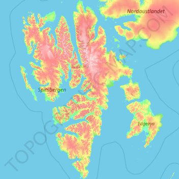
Name: Spitsbergen topographic map, elevation, terrain.
Location: Spitsbergen, Svalbard, Norway (76.55983 10.64755 80.06233 21.50078)
Average elevation: 154 m
Minimum elevation: -2 m
Maximum elevation: 1,648 m
Other topographic maps
Click on a map to view its topography, its elevation and its terrain.